- Contact MA
- Links
- Mineralogical Almanac
- New Data on Minerals
- Books
- From colleguaes, Vladivostok
- Mineral Shows of 2021
- Gemma, September 25-26
- Museum of Royal Institute of Natural Science, Brussels, Belgium
- MinTrips 2021
- Gemma, October 1-2, 2022
- View Cart
- Русский

Status: Sold Out
RUSSIAN MINERAL LOCALITIES SERIES
Valentina I. Popova, Vladimir A. Popov, Alexander A. Kanonerov
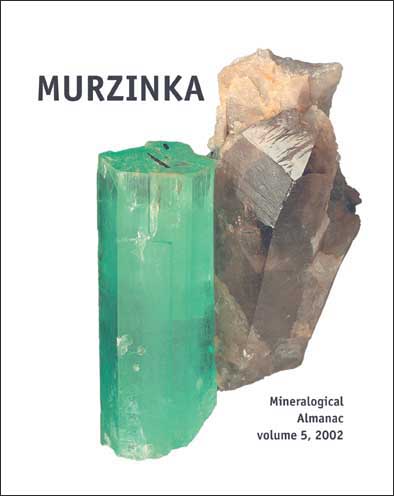
Murzinka: Alabashka Pegmatite Field. Mineralogical Almanac, volume 5, 2002
Introduction
Famous Murzinka and its outskirts is a region in the watershed of the Neiva river in the Middle Urals occurring in 100–120 km to the north of Ekaterinburg between 57°30'–57°45'N and 30°30'–31°E (Fig. 1). It is named after the Ostyak's Prince Murzin. Murzinka fort has been built in 1640 on the high, right bank of the Neiva river. With time, the fort became a rich Old Believers' village of Murzinskoe or simply Murzinka. Alexander Evgenievich Fersman (1925) wrote, «…even now one can see the remains of the old fort near the regional administration building… Perhaps, Murzinka was a southern and eastern guard of the Great Siberian road which passed through Solikamsk and Verkhoturie to Tobolsk in the 18th century…» Murzinka occurs in the center of the north-south trending Murzinka-Adui zone of the Ural Gemstone Belt. It is a 100 km long and 16 km wide strip at the western frame of the Murzinka granite massifs in the East Ural rise. The Ural Gemstone Belt is known for 300 years, but it received its name only in the beginning of the 20th century in the works by Konstantin Konstantinovich Matveev who was a founder of the department of mineralogy at the Ural Mining Institute. In 1920– 22, he was «forced to undertake excursions near Yekaterinburg because of revolutionary events» (cited from Emlin, 1996) and prepared a report after visiting the precious stone deposits in the Middle Urals (Matveev, 1924). The Alabashka field of granite pegmatites in the valley of the Alabashka river is the northernmost area of the Murzinka subzone of the Ural Gemstone Belt. It hosts mines of Mokrusha, Kazennitsa, Staraya Mylnitsa, Golodnaya, Tysyachnitsa and others. The Murzinka pegmatite field to the south, in the Neiva river valley, includes mines of Berillovaya, Buzheninov Bor, Kordieritovaya and others. There is no distinct boundary between these two areas. A demarcation line is traced along the swampy waterdivide of the Alabashka and Neiva rivers. There is opinion that the Gemstone Belt continues to the north of the Alabashka field, but that area is poorly explored. The distribution of mines within the Murzinka subzone of the Ural Gemstone Belt and its list of mines are shown in Figure 2 and Table 1. The following discussion is devoted to the most interesting pegmatites and their minerals described in the recent and historical publications (Ihrmann, 1836; Fersman, 1925, 1940, 1962; Smertenko et al., 1980; Talantsev, 1988; Arinshtein et al., 1996; Emlin, 1996; Popov and Popova, 1999; Popova et al., 1999; Gurkov, 2000; and others).
| Contents | |
| Introduction | 6 |
| HISTORY OF EXPLORATION AND MINING | 13 |
| GEOLOGICAL REVIEW | 32 |
| MORPHOLOGY AND STRUCTURE OF THE PEGMATITES | 39 |
Mokrusha |
39 |
Golodnaya |
46 |
Bolshaya Tyazhelovesnitsa |
50 |
Kazennitsa |
52 |
Staraya Mylnitsa |
57 |
Trekhsotennaya |
60 |
Krutorechenskaya |
61 |
Mys-II |
62 |
Tysyachnitsa |
62 |
| MINERALOGY | 67 |
| Conclusions | 118 |
| Glossary | 121 |
| References | 123 |
| Index of minerals | 127 |